- Two days in Batumi cover the boulevard, the old town, the Botanical Garden and Gonio Fortress; a third day takes you into Mtirala's rainforest or the mountains of Upper Adjara.
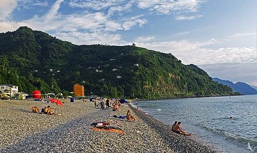
- Every beach on the Adjarian coast is pebble; the clearest water is south of the city at Kvariati and Sarpi, and the nearest sand is at Ureki in Guria.
- Swim from June to September; Batumi is Georgia's wettest city, with the heaviest rain from September to December and the driest weather in May.
- The fastest trains from Tbilisi take about 4 hours after the 2026 track upgrades, the drive takes 5 to 6 hours, and the road from Kutaisi takes about 2.5 hours.
Batumi is Georgia's Black Sea city and the capital of Adjara: a subtropical place of palms, pebble beaches, 19th-century streets and a skyline of new towers. Come between June and September for swimming, or in May and October for walking, gardens and day trips with fewer people around. Two full days cover the seafront, the old town, the Botanical Garden and the Roman fort at Gonio; a third lets you head into the forests of Mtirala or the mountain villages inland.
From Tbilisi the quickest option is now the train, about four hours on the fastest services, and Kutaisi airport is two and a half hours away by road. This guide covers what to see, the beaches worth your time, trips along the coast and into the hills, food, where to stay and what the famous rain means for your plans, with sample itineraries and answers to common questions.
Is Batumi worth visiting?
Batumi feels unlike anywhere else in Georgia: humid, green, lined with palms and magnolias, and facing west over open water, so the sunset is part of the daily routine. With roughly 187,000 people it is now the country's second city. Its past is layered, from a harbour known to Greek and Roman writers through centuries of Ottoman rule to an oil boom under the Russian Empire, and a mosque, a synagogue and several churches stand a few blocks apart.
It suits travellers who want the sea plus food, gardens and history within an hour's drive, and families do well on the flat, car-free seafront. It appeals less if you dislike crowds, casinos and high-rise towers, which dominate the southern seafront, or if you want sand. Treat it as a base: evenings in the city, days on the coast, in the forest and in the hills.
Batumi Boulevard and the old town
The seaside park called Batumi Boulevard is the spine of the city. Its shady northern part was planted from the 1880s, while the newer southern stretch runs past hotel towers to the dancing fountains at Ardagani Lake. Rent a bike or scooter to cover it all.
A walking loop through the old town
- Europe Square
Start where Medea holds up the Golden Fleece, a nod to ancient Colchis, and look for the astronomical clock on one of the facades. - The Piazza
An enclosed Italian-style square of cafes, mosaics and a bell tower, built around 2010 and lively on summer nights. - Old streets and places of worship
Wander past merchant houses with iron balconies from the oil-boom decades, the Orta Jame mosque of the 1860s, the 1904 synagogue and the Cathedral of the Mother of God, built as a Catholic church in the early 20th century. - The Argo cable car
Ride from near the port to Anuria hill for views over the harbour and the old town. - Sunset by the sea
End on the boulevard at sunset, then walk north to Ali and Nino and the Alphabetic Tower once they are lit.
Ali and Nino and the Alphabetic Tower
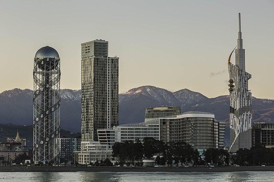
The moving steel sculpture of Ali and Nino is the best-known image of Batumi. Made by the Georgian artist Tamara Kvesitadze and set up on the seafront in 2010, it shows two tall figures of stacked rings that glide toward each other, merge for a moment and drift apart. It is named after the 1937 novel Ali and Nino, published under the pen name Kurban Said, about a Muslim boy from Baku and a Georgian Christian princess caught up in the First World War and the revolutions after it. Watch a full cycle, ideally after dark.
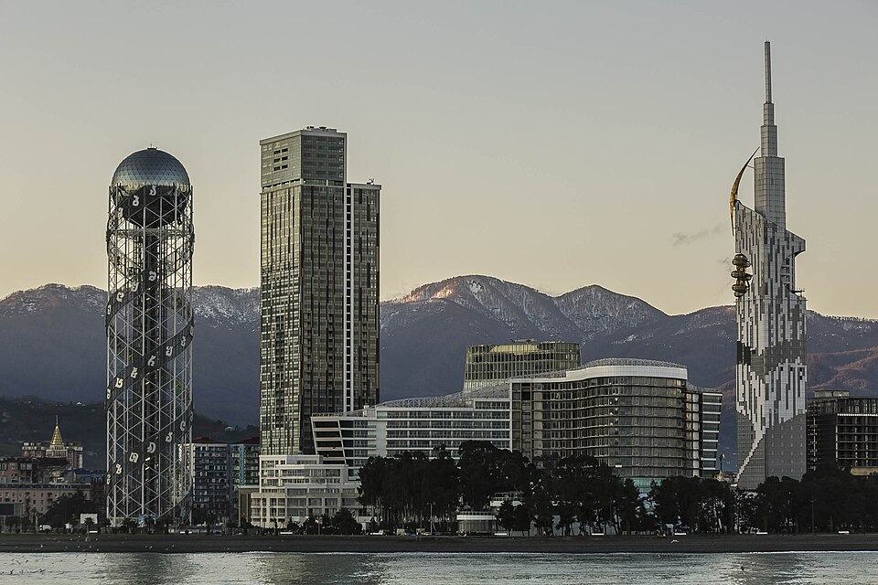
Close by, the Alphabetic Tower wraps the 33 letters of the Georgian alphabet around a double spiral of steel, next to the old lighthouse and a Ferris wheel.
Visiting the Batumi Botanical Garden at Mtsvane Kontskhi
The Botanical Garden covers the steep slopes of Mtsvane Kontskhi, the Green Cape, about 9 km north of the centre. The botanist Andrey Krasnov opened it in 1912 with the aim of gathering the plants of the world's humid subtropical regions in one place. Paths wind through some 108 hectares arranged by region of origin, so one walk leads from East Asian bamboo and tea bushes to Himalayan rhododendrons, Australian eucalyptus, Mexican agaves and a patch of native Colchic forest.
Allow at least three hours and wear proper shoes, because the garden climbs from the shore to over 200 m. Spring brings camellias, magnolias and azaleas into flower, and autumn brings colour and migrating raptors. Enter by one gate and leave by another to avoid retracing your steps, and in summer finish with a swim below the cape.
Batumi beaches: pebbles, the best stretches and where to swim
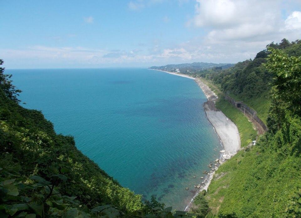
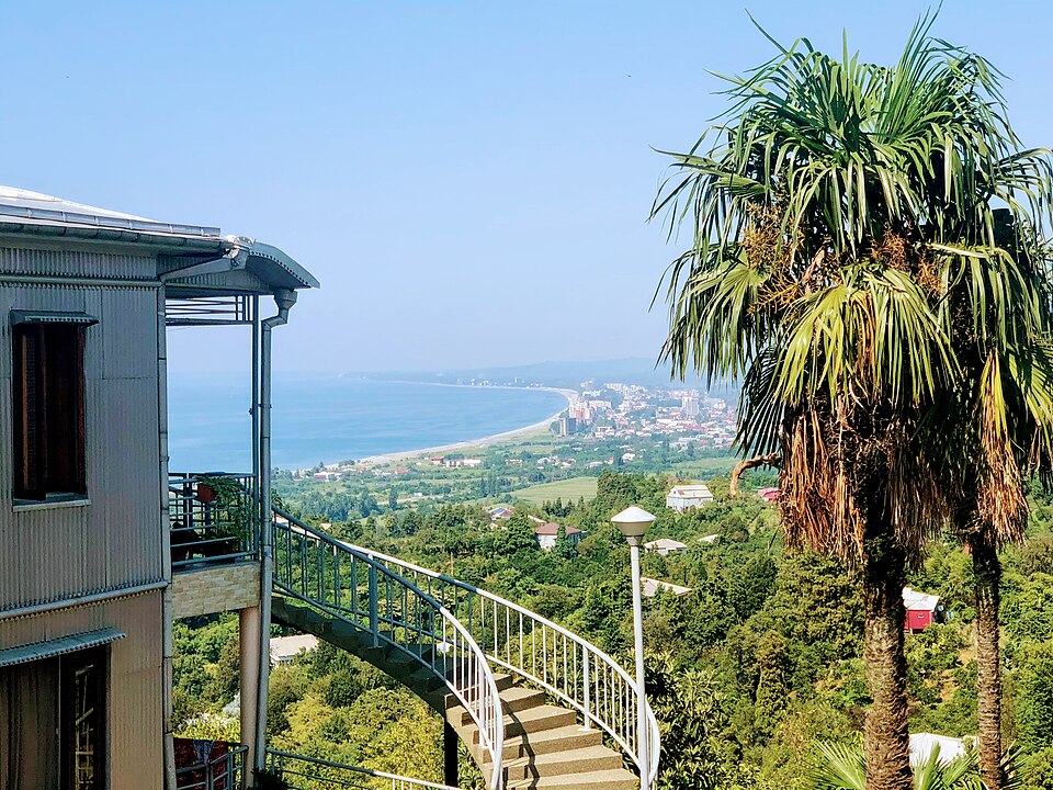
Expect pebbles all along the Adjarian coast, from fine gravel to fist-sized stones. The seabed drops away within a few metres, so watch children closely and wear water shoes. The sea is warmest in August, usually around 25 to 27°C, and calmest in the morning.
| Beach | Distance from the centre | What to expect |
|---|---|---|
| Central Batumi, old boulevard | In town | Convenient and lively, with loungers, cafes and lifeguards in summer; the busiest and least clear water |
| New Boulevard | 2 to 5 km south | Broad beach below the hotel towers, a little calmer than the centre |
| Green Cape and Makhinjauri | 6 to 9 km north | Smaller beaches under wooded hills, handy after the Botanical Garden |
| Chakvi and Tsikhisdziri | 10 to 23 km north | Quieter village beaches, with Petra Fortress above Tsikhisdziri |
| Kobuleti | 28 km north | Long, low-key family resort with guesthouses and a train station |
| Gonio | About 13 km south | Long beach close to the Roman fort, popular with families |
| Kvariati | About 15 km south | Small bay with some of the clearest water on the coast, good for snorkelling |
| Sarpi | About 18 km south | Last beach before the Turkish border, with clear water and rocks to jump from |
| Ureki, Guria | About 60 km north | The nearest sand, a dark magnetic beach in the neighbouring region |
For the cleanest water, head south. Beyond the mouth of the Chorokhi river, at Kvariati and Sarpi, green hills crowd the shore and the water is often transparent. Sarpi is a Laz village split by the border, with Turkish Sarp just across the checkpoint.
Gonio, Petra, Mtirala and Makhuntseti: the classic short trips
Gonio Fortress
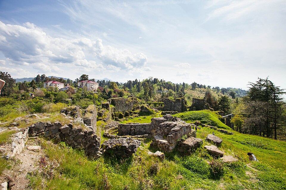
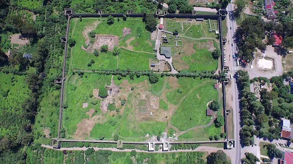
South of the city, Gonio is among the most complete Roman forts on the Black Sea. Its towered walls enclose the excavated foundations of barracks and baths and a spot honoured by local tradition as the grave of the Apostle Matthias. The Romans knew it as Apsaros; Byzantines and Ottomans used it later. Pair an hour inside with a swim at Kvariati.
Petra Fortress
North of Batumi, the ruins of Petra crown a rocky headland at Tsikhisdziri. Justinian built the stronghold in the 6th century to control Lazica, and it changed hands several times in the wars between Byzantium and Persia. A short, steep climb leads to wide coastal views and the outline of a basilica on the summit.
Mtirala National Park
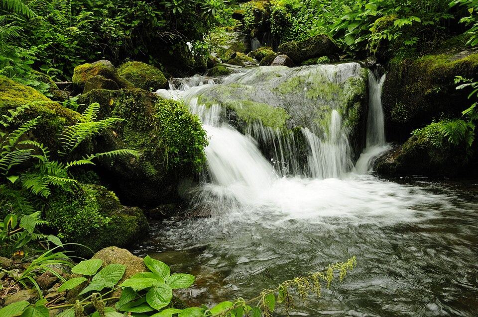
Mtirala, about an hour away via Chakvi, protects dense Colchic rainforest on a mountain whose name means weeping, a fair hint at the rainfall. From the visitor centre at Chakvistavi an easy trail of about 7 km follows the gorge to a waterfall and a small lake where people swim in summer. The forest is part of the UNESCO listing for the Colchic rainforests and wetlands, so pick a dry day and shoes that can cope with mud.
Makhuntseti Waterfall
Up the Adjaristskali valley, Makhuntseti is about 40 minutes east of the city and a few minutes' walk from the road, with a single-arched medieval bridge nearby that tradition credits to Queen Tamar.
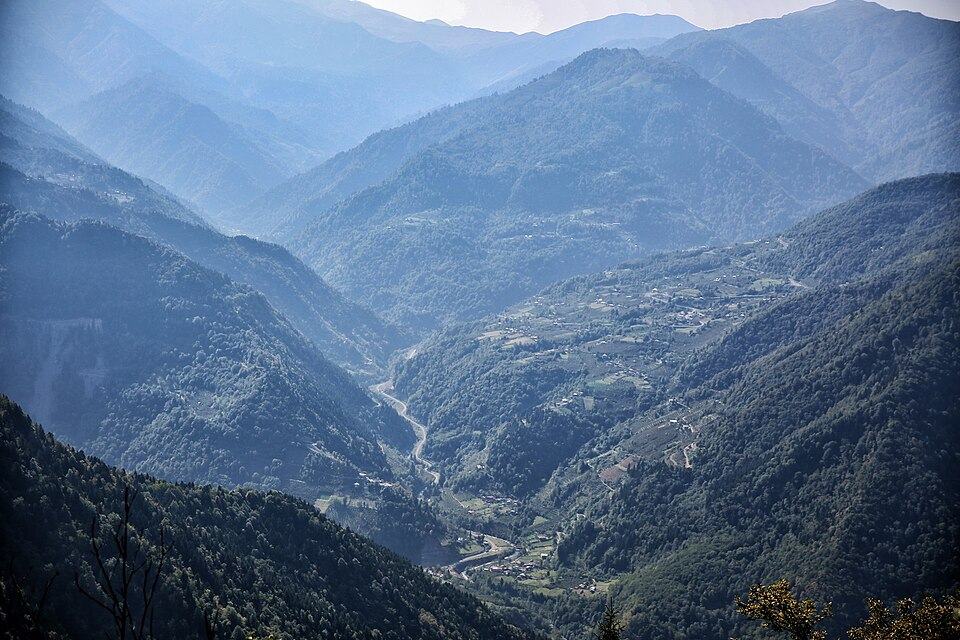
Day trips into mountain Adjara: Keda, Khulo, Green Lake and Goderdzi
The road east from Batumi follows the Adjaristskali river into Upper Adjara, and within an hour tea and citrus give way to steep valleys, wooden houses, hay barns and the slim minarets of village mosques, since most highland families are Muslim Georgians. The road is paved but winding, so allow more time than the distances suggest.
- Makhuntseti, 30 km, about 40 minutes
Waterfall, arched bridge and roadside stalls selling honey and cheese. - Keda, about 45 km, 1 hour
Adjara's wine district, where families grow Tsolikouri and the pink-skinned Chkhaveri grape on terraces above the river. Small family cellars welcome visitors, and the medieval Dandalo bridge is a short drive further on. - Shuakhevi
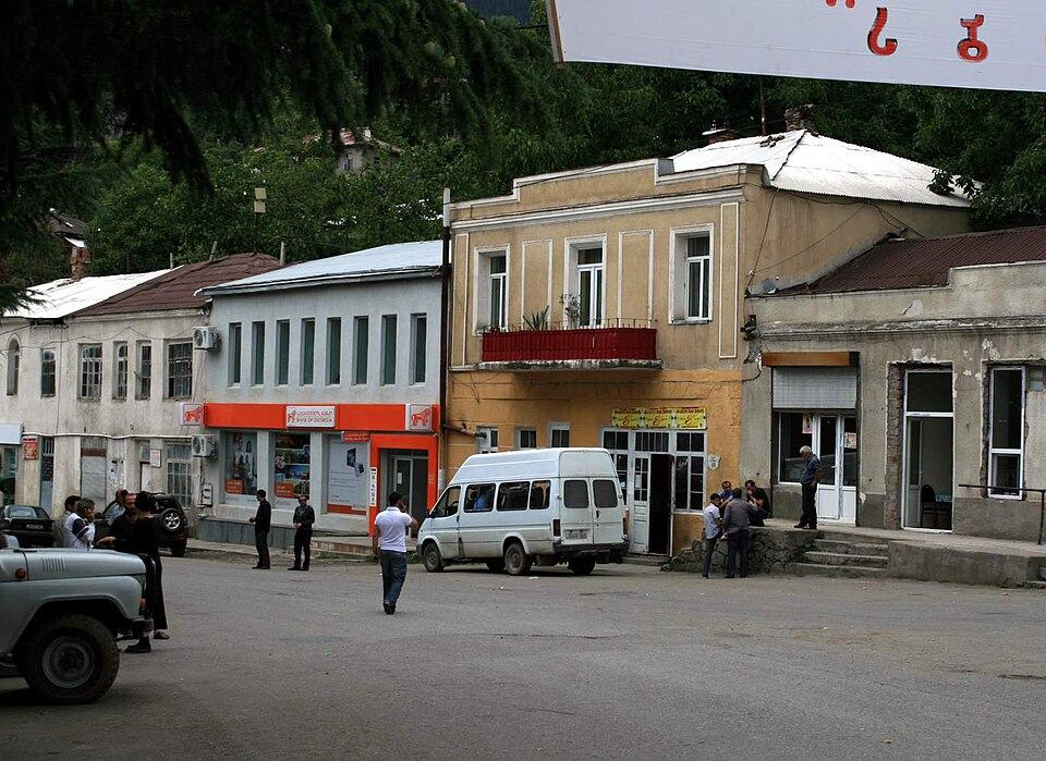
A coffee stop with views down the gorge. - Khulo, 88 km, about 2.5 hours
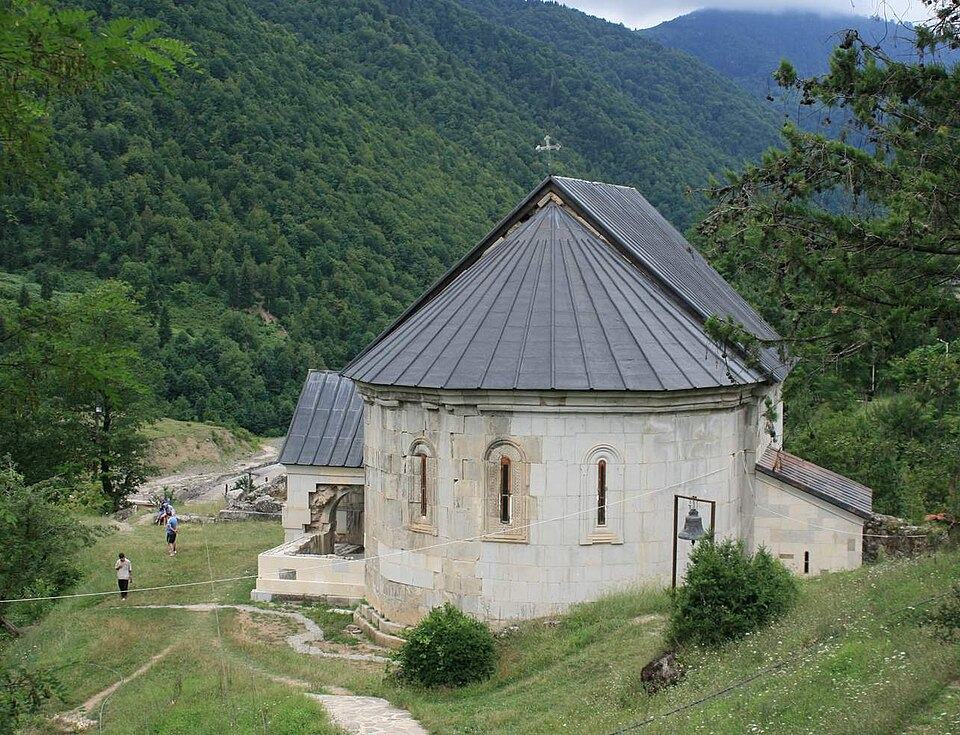
The main town of Upper Adjara at about 920 m, with guesthouses and hearty highland cooking. Ask whether the old cable car to Tago across the gorge is running, and visit the 13th-century Skhalta Cathedral in the next valley south. - Green Lake and Goderdzi, about 110 km, 3 to 4 hours
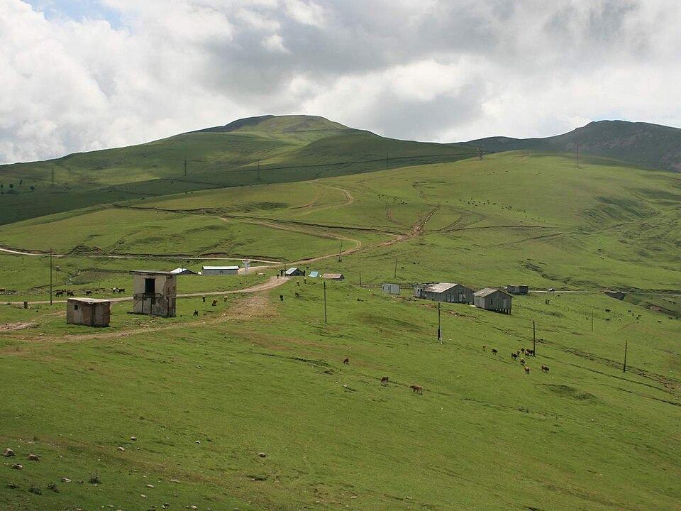
Higher still, the Goderdzi ski area lies near a 2,025 m pass, and Green Lake sits at about 2,060 m in the forest to the north, reached on a rough track by 4x4 or on foot. This part needs a night in the mountains.
Makhuntseti, Keda and Khulo make a realistic day trip if you leave early. For Green Lake or Goderdzi, sleep at least one night in Khulo, Tago or the summer village of Beshumi. Skiing at Goderdzi runs from about mid-December to early April; in winter you need winter tyres or a transfer.
What to eat in Batumi and Adjara
Adjarian cooking leans on butter, cheese and cream from the mountain pastures, and on fish and citrus from the coast. These are the dishes to look for.
- Adjaruli khachapuri: a boat of bread filled with molten cheese, finished with butter and an egg yolk. Stir both into the cheese, then tear off pieces of crust to dip. The small size is plenty for one person.
- Achma: layers of boiled dough and cheese baked like a soft lasagne, often eaten for breakfast or lunch.
- Borano and sinori: the two great highland dishes, one of cheese melted in ghee, the other of thin dough rolled with fresh curd cheese and butter.
- Chirbuli: a breakfast omelette with tomato and walnuts.
- Black Sea fish: hamsi, small anchovies fried crisp, in winter; red mullet, turbot or trout at other times. At the fish market a kitchen next door cooks what you buy.
- Pakhlava: Adjarian baklava, flaky and soaked in syrup, a legacy of the long Ottoman influence.
- Local wine: Chkhaveri, a light, often off-dry wine with a pale pink colour from Keda and neighbouring Guria, and white Tsolikouri.
Where to stay in Batumi: the best areas
| Area | Best for | Keep in mind |
|---|---|---|
| Old town | First visits, travellers without a car, restaurants and evening walks | Older buildings and some street noise at night; book early for July and August |
| Old boulevard seafront | Sea views and short walks to both the beach and the old town | Prices peak in summer |
| New Boulevard | Modern hotels and apartments, pools and a wider beach | High-rise and car-oriented, and farther from the old town |
| Makhinjauri and the Green Cape | Quiet hotels close to the Botanical Garden | You will need taxis to reach the centre |
| Gonio, Kvariati and Sarpi | Clear water, guesthouses and Gonio Fortress | 20 to 30 minutes from the city, with quieter evenings |
| Kobuleti | Families, longer beach stays and lower prices | About 40 minutes north; many places close outside summer |
| Khulo and Tago | Village stays, highland food, hiking and Green Lake | Two and a half hours inland on a winding road |
How to get to Batumi from Tbilisi and Kutaisi
| Route | How | Time | Notes |
|---|---|---|---|
| Tbilisi to Batumi | Train | About 4 hours on the fastest services | Several departures a day from Tbilisi Central; book ahead in summer |
| Tbilisi to Batumi | Car or private driver | 5 to 6 hours for about 370 km | On the E60 highway through the Rikoti tunnels and past Kutaisi |
| Tbilisi to Batumi | Marshrutka or bus | 6 to 7 hours | Cheapest and least comfortable; most leave from Didube |
| Kutaisi to Batumi | Car, taxi or minibus | About 2.5 hours for 150 km | Shuttle buses also connect Kutaisi airport with Batumi |
| From abroad | Flight | Varies | Batumi airport lies just south of the centre, with flights from Istanbul and seasonal routes from Europe and the Middle East |
| From Turkey | Road | About 30 minutes from the border | The Sarpi crossing is open, with buses from Turkish cities |
The train is the comfortable choice, with air conditioning, reserved seats and a buffet. Book on the Georgian Railway website or at stations, several days ahead in summer. Some trains also stop at Kobuleti, Ureki or Kutaisi Airport station. From Tbilisi, sit on the right for the final stretch beside the sea.
When to go to Batumi, and how much it rains
Batumi is the wettest city in Georgia, with roughly 2,400 to 2,500 mm of rain in an average year, about five times as much as Tbilisi. May is the driest month, averaging well under 100 mm, while autumn and early winter are the wettest, peaking at about 300 mm in November. Rain usually comes as heavy downpours between sunny spells, and even a summer week brings a few showers.
- May and early June: green and the least rainy, ideal for sightseeing and hiking, though the sea is still cool.
- Late June to August: peak beach season, humid, with daytime highs usually in the high 20s°C, the warmest sea and the biggest crowds.
- September: warm water, thinning crowds and the start of the autumn raptor migration, though the rain picks up.
- October and November: mild but wet, with the tangerine harvest in the hills and quiet streets.
- December to April: cool and peaceful on the coast, with skiing at Goderdzi from about mid-December.
Batumi in 2 or 3 days: sample plans
Two days
- Day 1: the city
Walk the old town in the morning and break for khachapuri. In the afternoon ride the Argo cable car, swim from the central beach and walk the boulevard at sunset to Ali and Nino. - Day 2: north or south
Spend the morning in the Botanical Garden and the afternoon at Petra and the beach at Tsikhisdziri. Or head south instead for Gonio Fortress, a long swim at Kvariati and a grilled fish dinner.
Adding a third day
- Day 3: forest or mountains
Choose Mtirala for a rainforest walk to the waterfall and lake, or drive inland to Makhuntseti, Keda and Khulo for wine, stone bridges and highland cooking. Stay over in Khulo if you can and go up to Green Lake the next morning.
Batumi also makes a fine finale to a longer route: our From the Mountains to the Sea tour ends here after Kazbegi, Borjomi, Vardzia and Kutaisi.
Batumi travel FAQ
How many days should I spend in Batumi?
Two days are enough for the old town, the boulevard, the Botanical Garden and Gonio. Add a third for Mtirala National Park or Upper Adjara, and a fourth if you want real beach time.
What is the fastest way from Tbilisi to Batumi?
The train, which takes about 4 hours on the quickest services since the 2026 track upgrades. Driving takes 5 to 6 hours, and marshrutkas a little longer. Book train seats several days ahead in July and August.
Does Batumi have sandy beaches?
No. Batumi and the rest of the Adjarian coast have pebble beaches that shelve quickly into deep water. The nearest sand is at Ureki and Shekvetili in Guria, about an hour to the north.
When is the best time to visit Batumi?
June and September are the sweet spots, with a warm sea, smaller crowds than in high summer and less rain than in autumn. May and early October suit gardens, sightseeing and hiking better than swimming.
Does it rain a lot in Batumi?
Yes. It is Georgia's wettest city, with about 2,400 to 2,500 mm a year. The heaviest rain falls between September and December, and May is the driest month.
Can you visit Turkey from Batumi?
Yes. The Sarpi crossing is about 30 minutes south of the city, and buses continue to Hopa, Rize and Trabzon. Check the entry rules for your passport before you go.