Omalo to Shatili over the Atsunta Pass (Tusheti to Khevsureti)
Georgia's classic high traverse: five days from the slate villages of Tusheti across the 3,430 m Atsunta saddle to Shatili, the walled tower village of Khevsureti. About 76 km, 2,950 m up and 3,550 m down, with border registration in Girevi, two remote camps and several river fords.
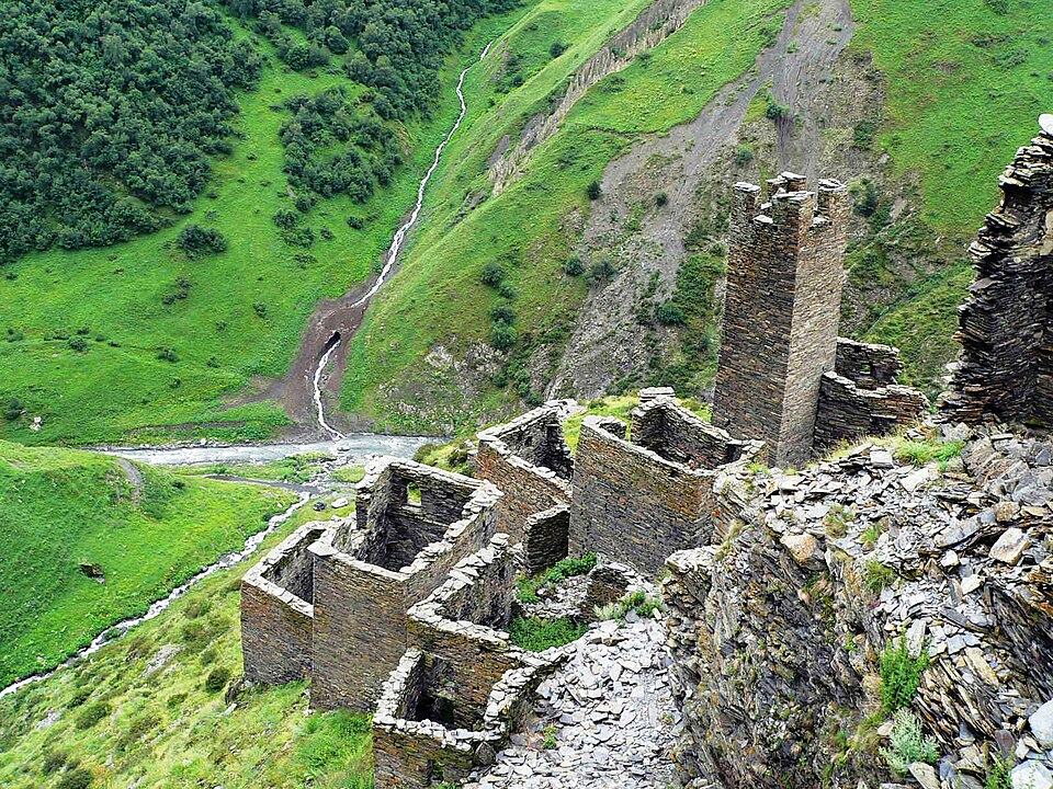 MutsoPhoto: Giorgimailo, CC BY-SA 4.0
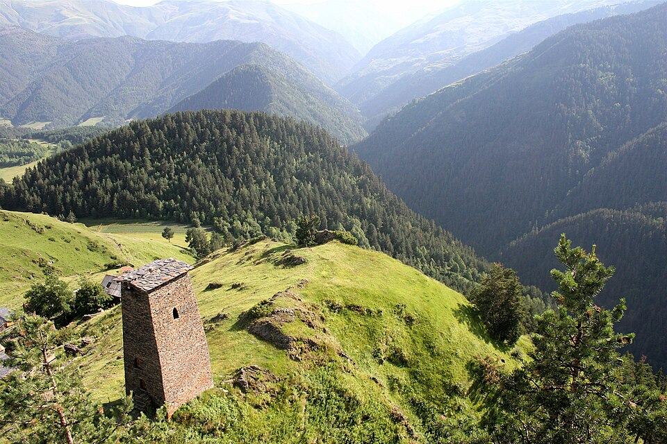
This trek links two of Georgia's most isolated highland regions, both cut off by snow for much of the year. It starts in Omalo, the summer centre of Tusheti, follows the Pirikiti Alazani valley past Dartlo, Parsma and Girevi, climbs a wild side valley to the Atsunta Pass and drops into Khevsureti, finishing among the towers of Mutso and Shatili.
The first two days are on village tracks with guesthouses. Days 3 and 4 are remote, with camping, unbridged river crossings and the long climb to the pass, the hardest day of the trek. There are no shops after Omalo, so carry food for at least three days or arrange supplies with a horseman.
Most walkers hire pack horses from Omalo or Girevi to carry tents and food over the pass. Because the horses have to walk back to Tusheti, this is more expensive than a normal day of horse hire; agree the price for the full return before you set off. A guide who knows the river crossings and the border procedures makes the trip much easier, and in poor weather the pass can be hard to find.
Highlights
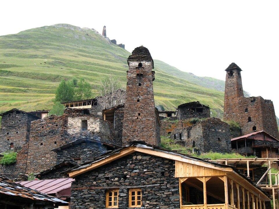
- The tower villages of Dartlo, Chesho and Parsma
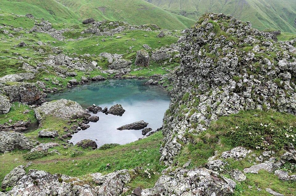
- Wild camping under the Atsunta Pass with no road for days
- Crossing the main watershed between Tusheti and Khevsureti at about 3,430 m
- Mutso, perched on its ridge above the Andaki river
- Arriving in Shatili, the fortified village of stone houses joined by passages and towers
Trail facts
Last checked Oct 2026 by the Maspindzeli team. Mountain conditions change: ask us before you go.
Is this right for you?
Three quick questions for a friendly second opinion. Nothing is sent anywhere.
Stage by stage
| Day | From → to | Distance | Up | Down | Hours | Highest |
|---|---|---|---|---|---|---|
| 1 | Omalo → Dartlo | 11 km | +400 m | −650 m | 4-5 h | 2,150 m |
| 2 | Dartlo → Girevi | 17 km | +550 m | −300 m | 6-7 h | 2,150 m |
| 3 | Girevi → Kvakhidi meadows | 15 km | +650 m | −250 m | 5-6 h | 2,500 m |
| 4 | Kvakhidi camp → Khidotani valley camp | 15 km | +1,100 m | −1,200 m | 8-10 h | 3,430 m |
| 5 | Khidotani → Shatili | 18 km | +250 m | −1,150 m | 6-7 h | 2,400 m |
01Omalo to DartloOmalo → Dartlo · 11 km · 4-5 h
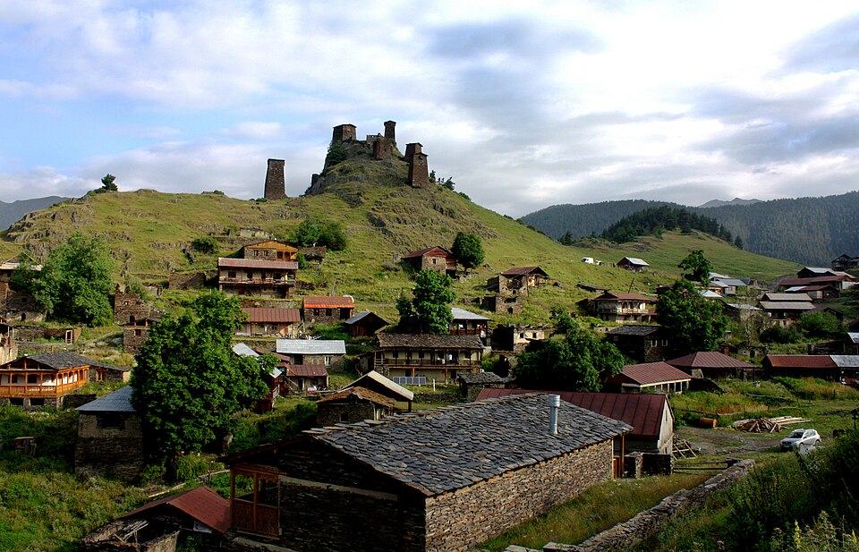
Leave Omalo below the Keselo towers, drop to the Pirikiti Alazani and follow paths and the jeep track up the valley. The day is short so there is time to explore Dartlo, its towers and the stone seats where village elders once held council. Guesthouse night in Dartlo.
02Dartlo to GireviDartlo → Girevi · 17 km · 6-7 h
Continue up the valley through Chesho and Parsma, two hamlets with fine defensive towers, and on to Girevi, where the year-round houses of the valley end. Register with the border police at the post in Girevi this afternoon so you can leave early tomorrow. Simple guesthouse or camping.
03Girevi to the Kvakhidi campGirevi → Kvakhidi meadows · 15 km · 5-6 h
Beyond Girevi the path heads up the main valley toward the Khevsureti watershed, then turn up the Kvakhidi side valley. The path is faint in places and fords several side streams; cross early, before snowmelt raises the water. Camp in the high meadows at roughly 2,400 to 2,500 m.
04Over the Atsunta Pass to KhidotaniKvakhidi camp → Khidotani valley camp · 15 km · 8-10 h
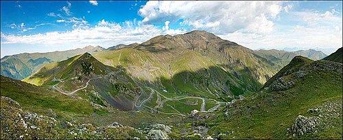
The crux. Ford the Kvakhidi stream, usually twice, then gain height steadily over grass, scree and old snow until you top out on the saddle, roughly 3,430 m. On a clear day the view takes in Tebulo and the peaks along the Chechen border. The descent into Khevsureti is long and steep on loose ground before the path reaches the upper Andaki side valleys around Khidotani, where you camp.
05Khidotani to Mutso and ShatiliKhidotani → Shatili · 18 km · 6-7 h
Show your registration at the border police post and walk down the Andaki valley past Ardoti to Mutso, a cluster of towers on a near-vertical ridge above the river. From Mutso a dirt road leads 12 km down the Argun valley to Shatili; walk it or take a pre-booked car. Celebrate in a Shatili guesthouse among the stone towers.
Practical information
Getting there
Take a minibus from Tbilisi (Ortachala or Samgori bus area) to Kvemo Alvani in Kakheti, roughly 2.5 hours for about 15 to 18 GEL (around $6 to $7) in 2026. From Alvani a 4x4 crosses the Abano Pass (about 2,850 m) to Omalo: 72 km of dirt road, 4 to 5 hours, about 100 to 120 GEL (about $37 to $44) per seat in a shared jeep or 500 to 650 GEL (about $185 to $240) for the whole car. The road is usually open from June to late October; check the opening date each year.
Getting back
From Shatili a minibus runs to Tbilisi Didube twice a week in summer (usually Thursday and Sunday around midday, about 5 hours, about 35 GEL or $13 in 2026). Otherwise arrange a 4x4 with driver from Shatili to Tbilisi over the Datvisjvari Pass, roughly 4 hours and about 400 to 500 GEL (about $150 to $185). Many groups end the walk at Mutso and drive the last 12 km to Shatili.
Water
Streams and springs on every day except the Atsunta crossing itself: from the last stream above the Kvakhidi camp to the first water on the Khidotani side there can be 4 to 5 hours without a source, so carry 2 to 3 litres. All water is in grazed valleys, so filter or treat it.
Phone signal
Omalo and Dartlo have mobile coverage in summer, often weak. Between Parsma and Mutso expect none for two to three days. Shatili has some coverage near the guesthouses. A satellite messenger or a guide's radio is strongly advised.
Nearest help
Tusheti has no hospital: Omalo has a basic medical point in summer and helicopter evacuation is the normal route out in an emergency. The border police posts at Girevi and on the Khevsureti side are staffed and can relay calls. Shatili has a seasonal medical point; the nearest hospital is in Tbilisi, about 5 hours away. Dial 112 when you have signal.
Permits
The route runs close to the Russian border (Chechnya), so every walker signs in with the border guards at their Girevi post before going further. Bring your passport; the paperwork usually takes about an hour and is free. Keep the registration paper and show it at the border police post on the Khevsureti side near Khidotani or Mutso. It is also worth signing in at the Tusheti Protected Areas visitor centre in Kvemo Omalo, which is free and gives the rangers your plan.
Gear and safety
What to bring
- Passport (essential for the border registration)
- Tent, sleeping mat and a bag comfortable down to minus 5 degrees C or so
- Stove, gas and food for three days; buy gas in Tbilisi or Telavi, as Omalo shops are tiny and erratic
- Sandals or neoprene socks and poles for river fords
- Waterproofs, a warm jacket, hat and gloves for the pass
- Water filter or tablets
- Cash in GEL for guesthouses, horses and drivers; there are no ATMs in Tusheti or Shatili
- Satellite messenger and offline maps
- First-aid kit with blister care and personal medicines
Stay safe
- River crossings are the biggest danger. Ford early in the morning when the water is lowest, unclip your hip belt, face upstream and link arms in groups. If a ford looks too fast, wait or look upstream for a wider, shallower spot.
- Never cross the border or walk along the ridge toward Chechnya; stay on the registered route and follow the instructions of the border police.
- Weather on the pass changes fast. Start day 4 at first light and turn back to the Kvakhidi camp if the pass is in thick cloud or a storm is building.
- Tush and Khevsur sheepdogs are big and protective. Stop, keep the group together and let the shepherd call them back; never come between a dog and its flock.
- Rescue is slow. Helicopter evacuation is possible but can take many hours, so carry a proper first-aid kit and a way to call for help.
- Emergency number 112 (if you have signal); give the nearest landmark such as Girevi, Atsunta or Mutso.
- 4-day version: Omalo to Girevi in one long day (about 26 km), then the same three days to Shatili. Only for very fit walkers.
- On horseback: the whole route can be ridden in 5 to 6 days with Tush horsemen, walking the steepest parts of the pass.
- Reverse direction: Shatili to Omalo works too, but you must still register with the border police and the climb to Atsunta from the Khevsureti side is longer and steeper.
- If the pass is closed by snow or storm: stay in Tusheti and walk Dartlo to Parsma and back, or the Omalo to Diklo walk toward the Dagestan border, then leave by jeep over the Abano Pass.
- Different crossing: the Borbalo Pass route links Tusheti and Khevsureti further south through Pshavi and avoids the high Atsunta crossing, but it is also about 5 days and remote.
Emergency number in Georgia: 112. Tell your guesthouse your plan before you set off.
Places on and near the route
Tours that include this trail
Omalo to Shatili over the Atsunta Pass (Tusheti to Khevsureti): FAQ
Do I need a permit for Omalo to Shatili?
Yes, a free border-zone registration with the border police in Girevi, done in person with your passport. Allow about an hour and keep the paper for the check on the Khevsureti side.
How difficult is the Atsunta Pass trek?
Hard. Two days are remote with camping, the pass day is 8 to 10 hours with over 1,000 m of both ascent and descent, and there are several unbridged river crossings.
Can I do it without a guide?
Experienced trekkers with navigation skills do. A guide or horseman helps with river crossings, finding the path above Kvakhidi and dealing with the border police.
When is the best time?
Late July and August. In early July snow may still block the pass and rivers run high; from mid-September the weather turns and horse support becomes hard to find.
How do I get home from Shatili?
By the twice-weekly minibus to Tbilisi or a pre-booked 4x4. Book the car before you start, as there is no reliable signal on the trail.
Last checked Oct 2026 by the Maspindzeli team. Mountain conditions change: ask us before you go.