Black Rock Lake Trek, Lagodekhi National Park
A three-day loop through Georgia's oldest nature reserve, from beech forest at 550 m up to a cold tarn of roughly 2,800 m right on the Russian border, with nights in mountain shelters. About 40 km and 2,850 m of ascent and descent.
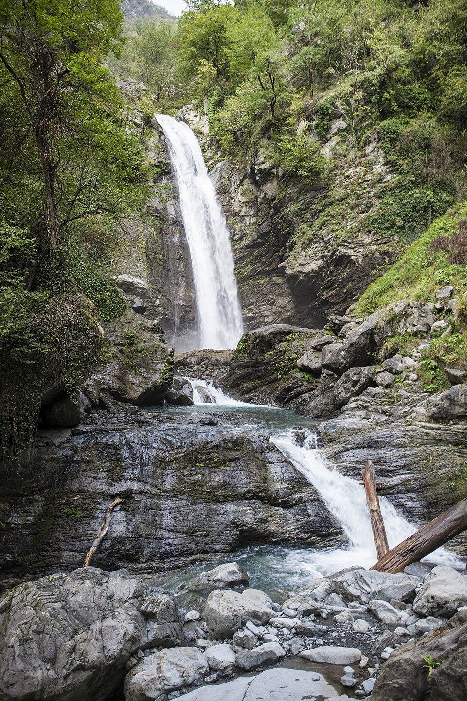 Lagodekhi National ParkPhoto: Paata vardanashvili, CC BY-SA 4.0
Lagodekhi, protected since 1912, covers the steep southern slope of the Greater Caucasus above the Alazani plain. In a single climb you pass from humid lowland forest of hornbeam, oak and chestnut through tall beech to subalpine birch and finally open alpine meadows. Black Rock Lake (Shavi Kldeebis Tba) lies at the top, a cold glacial tarn under dark cliffs on the watershed that forms the border with Dagestan.
The trek is demanding mainly because of the height gain. Day 1 climbs about 1,450 m almost without a break, through forest with little water. Day 2 crosses the alpine zone to the lake and back to a shelter, and day 3 is a long, knee-testing descent of over 2,000 m. Rangers manage the route and the shelters, and the trail is waymarked.
Official distances differ: the park lists the route at 48 km, its other site at 42 km, and GPS tracks of the loop come out nearer 38 to 40 km. The difference is in which descent route you take and whether you include side trips. Plan for 3 days in any case.
Highlights
- Climbing through every vegetation zone of the Caucasus in one day
- Old-growth beech forest in Georgia's first protected area
- Black Rock Lake under dark cliffs on the main Caucasus watershed
- Clouds filling the Alazani valley below the alpine meadows
- Possible sightings of East Caucasian tur, chamois and birds of prey
Trail facts
Last checked Oct 2026 by the Maspindzeli team. Mountain conditions change: ask us before you go.
Is this right for you?
Three quick questions for a friendly second opinion. Nothing is sent anywhere.
Stage by stage
| Day | From → to | Distance | Up | Down | Hours | Highest |
|---|---|---|---|---|---|---|
| 1 | Lagodekhi visitor centre → Meteo shelter | 12 km | +1,450 m | −50 m | 6-8 h | 2,000 m |
| 2 | Meteo shelter → Upper (Demidov) shelter | 13 km | +1,100 m | −400 m | 6-8 h | 2,900 m |
| 3 | Upper shelter → Lagodekhi visitor centre | 15 km | +300 m | −2,400 m | 6-7 h | 2,650 m |
01Visitor centre to the Meteo shelterLagodekhi visitor centre → Meteo shelter · 12 km · 6-8 h
From the visitor centre the path heads into the forest along the Lagodekhi river and soon starts climbing the ridge. It rises relentlessly on a good path through beech and hornbeam, with few views and almost no water after the first hour. Near the top the forest thins into birch and you reach the Meteo shelter, at around 1,950 to 2,000 m, on the edge of the meadows.
02Meteo shelter to Black Rock Lake and the upper shelterMeteo shelter → Upper (Demidov) shelter · 13 km · 6-8 h
Leave early across open alpine grassland, climbing gradually along the ridge with views south over the Alazani valley to the Lesser Caucasus on a clear day. A last steeper pull ends at the lakeshore, close to 2,800 m, directly under the border ridge. Rest, then descend to the upper shelter on the meadows at about 2,650 m. Expect cloud to roll up from the valley by midday; follow the waymarks closely.
03Down to LagodekhiUpper shelter → Lagodekhi visitor centre · 15 km · 6-7 h
Descend through the subalpine zone and then the full depth of the forest back to the valley. The path is steep and often muddy and slippery under the beeches. Poles and good soles make a big difference. You arrive back at the visitor centre in the afternoon.
Practical information
Getting there
Lagodekhi sits roughly 160 km east of the capital, a drive of 2.5-3 hours across Kakheti. Several minibuses a day leave the Samgori bus area in Tbilisi; the 2026 fare was around 15 GEL (around $6). A private car with driver costs about 250 to 320 GEL (about $95 to $120) one way. The visitor centre is at the northern edge of town, a 20-minute walk or short taxi ride from the minibus stop. Buy all food for the trek in Lagodekhi; nothing is sold in the park.
Getting back
The loop brings you back to the visitor centre. Minibuses to Tbilisi leave Lagodekhi until late afternoon; after a 15 km descent most people prefer a night in a Lagodekhi guesthouse or a pre-booked car. Kvareli and Sighnaghi are each about an hour away for a wine stop on the way back.
Water
This is the main logistical problem. The long forest climb on day 1 is largely dry after the first streams near the bottom, so start with 3 litres. There is water near the shelters and from snowmelt and small streams on the alpine meadows on day 2; treat it. Refill whenever you can on the descent.
Phone signal
Good in Lagodekhi town and the lower forest. Mostly none on the forested ridge, with occasional bars on high open ground on day 2, sometimes from Azerbaijani networks near the border (roaming charges may apply). Rangers at the shelters carry radios.
Nearest help
Rangers stationed at the mountain shelters in season, and the visitor centre in Lagodekhi. Lagodekhi town has a hospital and pharmacies. Dial 112; evacuation from the lake area may need a helicopter or horses.
Permits
Register at the Lagodekhi Protected Areas visitor centre before you start and carry a copy of your passport or ID; rangers will not let you onto the trail without it. Black Rock Lake lies on the state border with Russia (Dagestan), and border police patrol the ridge: carry the original passport too and never cross the watershed. In 2026 the tourist shelter cost about 30 GEL (about $11) per person a night (about 20 GEL for students) and a tent pitch about 5 GEL (about $2); book the shelter at the visitor centre.
Gear and safety
What to bring
- Boots with a good tread for wet roots and mud
- Trekking poles for the 2,400 m descent
- Capacity for 3 litres of water plus a filter
- Stove and gas: there is no firewood above the treeline and the shelters do not sell food
- Sleeping bag to about 0 degrees C (shelter) or minus 5 degrees C if camping
- Rain gear: Lagodekhi is one of the wettest corners of eastern Georgia
- Passport plus a photocopy for the registration
- Insect repellent and tick checks for the forest section
Stay safe
- Do not cross or walk along the border ridge. Border guards patrol here; stop if asked and show your documents.
- Weather on the ridge changes within an hour. In fog, stay on the waymarked line and wait rather than guess; the meadows look the same in every direction.
- Lightning is a serious risk on the open ridge in summer afternoons. Aim to reach the lake before noon.
- Ticks are common in the lower forest from spring to autumn. Check yourself each evening and remove any you find.
- Brown bears live in the reserve. Keep food sealed, cook away from your tent and make noise in dense forest.
- Shepherds bring flocks with large dogs onto some meadows next to the reserve in summer. Keep your distance and do not try to feed or pet them.
- Dial 112 in an emergency, or reach the shelter rangers, who have radio contact with the visitor centre.
- 4 days: add a rest night at the upper shelter, which makes the lake day relaxed and gives a second chance if day 2 is in cloud.
- Out and back: some walkers return the way they came instead of using the loop descent; the distance is similar.
- Shorter Lagodekhi walks: the Ninoskhevi waterfall trail (about 8.5 km, 4 to 6 hours) or the Black Grouse waterfall trail (about 9.5 km, 3 to 5 hours) when the high ground is in cloud.
- Bad weather swap: the forest day trails stay usable in light rain; in heavy rain the river crossings on the waterfall paths become dangerous, so visit the wineries of Kvareli or the town of Sighnaghi instead.
- With horses: the park can arrange horses to carry packs to the shelters; ask at the visitor centre a day ahead.
Emergency number in Georgia: 112. Tell your guesthouse your plan before you set off.
Places on and near the route
Black Rock Lake Trek, Lagodekhi National Park: FAQ
How long is the Black Rock Lake trek?
Three days and about 40 km by most GPS records. The park's own figure is 48 km, and other official listings say 42 km, depending on the variant.
Do I need a guide for Black Rock Lake?
No, the trail is waymarked and managed by rangers. A guide is useful in poor visibility and for logistics. You must register at the visitor centre either way.
Can I sleep in a hut?
Yes. There are tourist shelters on the route; in 2026 a bed cost about 30 GEL a night. Book at the visitor centre, and bring your own food and stove.
When is Black Rock Lake trek open?
The park allows it from June to October. July to mid-September has the most reliable conditions.
Can I swim in the lake?
The water comes from snow and ice and stays near freezing all summer. Ask the rangers; a quick dip is not forbidden everywhere, but it is a protected area, so do not use soap.
Last checked Oct 2026 by the Maspindzeli team. Mountain conditions change: ask us before you go.